Corporation Street, Swindon
Introduction
The photograph on this page of Corporation Street, Swindon by Vieve Forward as part of the Geograph project.
The Geograph project started in 2005 with the aim of publishing, organising and preserving representative images for every square kilometre of Great Britain, Ireland and the Isle of Man.

There are currently over 7.5m images from over 14,400 individuals and you can help contribute to the project by visiting https://www.geograph.org.uk
Corporation Street, Swindon
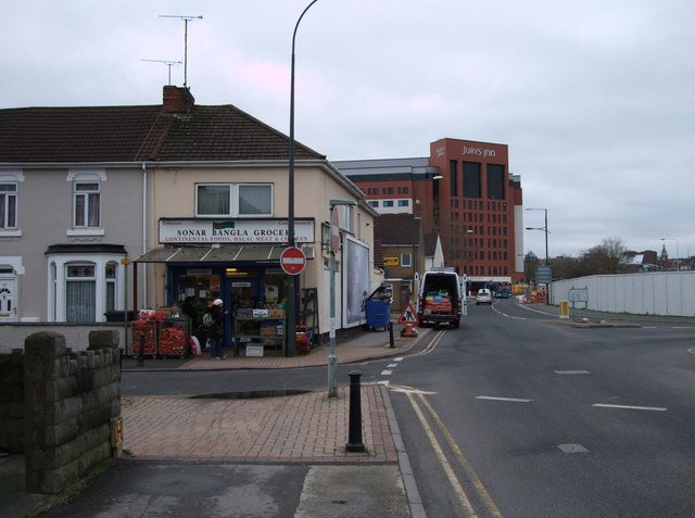
Image: © Vieve Forward Taken: 25 Jan 2012
View northwards up Corporation Street. In the foreground is one of the ethnic shops typical of the Broad Street/Manchester Road area, while in the background towers Jurys Inn. Between the two are the roadworks for the new Whalebridge roundabout layout, while to the right, the white hoardings enclose the vacant lot where Davis House Salvation Army hostel formerly stood.
Images are licensed for reuse under creativecommons.org/licenses/by-sa/2.0
Image Location
Latitude
51.562233
Longitude
-1.780247