Hertford Loop Line
Introduction
The photograph on this page of Hertford Loop Line by Martin Addison as part of the Geograph project.
The Geograph project started in 2005 with the aim of publishing, organising and preserving representative images for every square kilometre of Great Britain, Ireland and the Isle of Man.

There are currently over 7.5m images from over 14,400 individuals and you can help contribute to the project by visiting https://www.geograph.org.uk
Hertford Loop Line
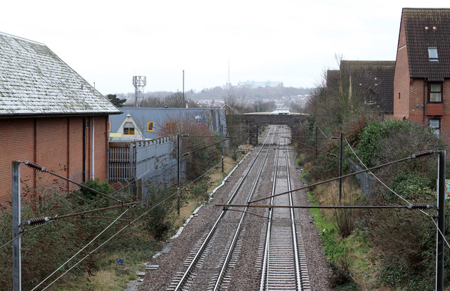
Image: © Martin Addison Taken: 20 Jan 2012
The railway line seen on the approach to Palmers Green station. The building on the left is Morrison's supermarket. The bridge in the distance carries Broomfield Lane over the line. Alexandra Palace is just visible through the murk on the horizon.
Images are licensed for reuse under creativecommons.org/licenses/by-sa/2.0
Image Location
Latitude
51.617739
Longitude
-0.111111