The New River and Russell Road
Introduction
The photograph on this page of The New River and Russell Road by Martin Addison as part of the Geograph project.
The Geograph project started in 2005 with the aim of publishing, organising and preserving representative images for every square kilometre of Great Britain, Ireland and the Isle of Man.

There are currently over 7.5m images from over 14,400 individuals and you can help contribute to the project by visiting https://www.geograph.org.uk
The New River and Russell Road
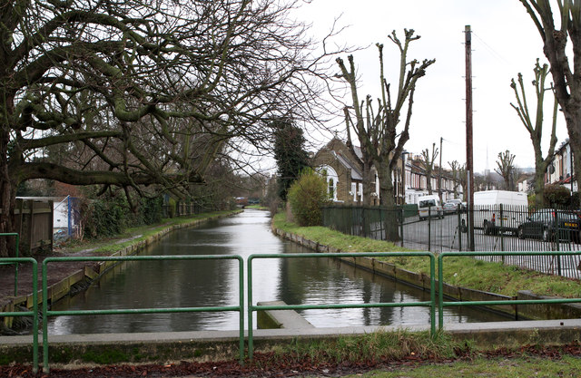
Image: © Martin Addison Taken: 20 Jan 2012
Seen as it emerges from the concrete tunnel that carries it under the North Circular Road, The New River was constructed in the early 17th Century to provide water for London. It remains an essential part of London's water supply to this day. On the left bank is the New River Path which allows pedestrians to follow its course. On the right is Russell Road and the Elim Pentecostal church.
Images are licensed for reuse under creativecommons.org/licenses/by-sa/2.0
Image Location
Latitude
51.611686
Longitude
-0.114973