Broadheath Church of England Primary School (2), Sailor's Bank, Lower Broadheath
Introduction
The photograph on this page of Broadheath Church of England Primary School (2), Sailor's Bank, Lower Broadheath by P L Chadwick as part of the Geograph project.
The Geograph project started in 2005 with the aim of publishing, organising and preserving representative images for every square kilometre of Great Britain, Ireland and the Isle of Man.

There are currently over 7.5m images from over 14,400 individuals and you can help contribute to the project by visiting https://www.geograph.org.uk
Broadheath Church of England Primary School (2), Sailor's Bank, Lower Broadheath
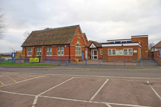
Image: © P L Chadwick Taken: 27 Dec 2011
This view is of the frontage to Church Lane. The school was built in the early 1870's, incorporated the former church of 1836 in the early 1900's, and since then there have been modern additions. Image Image
Images are licensed for reuse under creativecommons.org/licenses/by-sa/2.0
Image Location
Latitude
52.213315
Longitude
-2.279645