Pastureland above Wdig/Goodwick
Introduction
The photograph on this page of Pastureland above Wdig/Goodwick by Natasha Ceridwen de Chroustchoff as part of the Geograph project.
The Geograph project started in 2005 with the aim of publishing, organising and preserving representative images for every square kilometre of Great Britain, Ireland and the Isle of Man.

There are currently over 7.5m images from over 14,400 individuals and you can help contribute to the project by visiting https://www.geograph.org.uk
Pastureland above Wdig/Goodwick
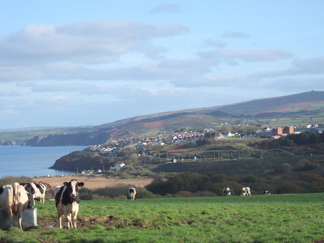
Image: © Natasha Ceridwen de Chroustchoff Taken: 9 Nov 2006
These cows, when not looking at the photographer, have a splendid view across the valley towards Fishguard and beyond. The double-ended brick building midway down the right hand side of the picture is Fishguard School and line of lights below it indicates the route of the 'new' by-pass.
Images are licensed for reuse under creativecommons.org/licenses/by-sa/2.0
Image Location
Latitude
51.996657
Longitude
-5.005049