Exhall: The Old Black Bank Inn
Introduction
The photograph on this page of Exhall: The Old Black Bank Inn by Nigel Cox as part of the Geograph project.
The Geograph project started in 2005 with the aim of publishing, organising and preserving representative images for every square kilometre of Great Britain, Ireland and the Isle of Man.

There are currently over 7.5m images from over 14,400 individuals and you can help contribute to the project by visiting https://www.geograph.org.uk
Exhall: The Old Black Bank Inn
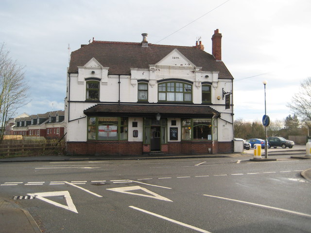
Image: © Nigel Cox Taken: 31 Dec 2011
The Old Black Bank Inn is on the B4113 at the boundary between Bedworth and Exhall. From the date in the gable the current pub dates from 1899, but the earliest large scale Ordnance Survey mapping currently available on line, dating from 1887, also shows a "Black Bank Inn", so evidently there was some form of beer house here serving the local mining community before the current pub was built. The pub has got a very good, informative, and well laid out website here http://www.theoldblackbank.co.uk/
Images are licensed for reuse under creativecommons.org/licenses/by-sa/2.0
Image Location
Latitude
52.473567
Longitude
-1.477178