Under the A38
Introduction
The photograph on this page of Under the A38 by Ruth Riddle as part of the Geograph project.
The Geograph project started in 2005 with the aim of publishing, organising and preserving representative images for every square kilometre of Great Britain, Ireland and the Isle of Man.

There are currently over 7.5m images from over 14,400 individuals and you can help contribute to the project by visiting https://www.geograph.org.uk
Under the A38
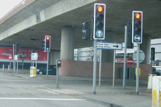
Image: © Ruth Riddle Taken: 6 Jan 2012
Where Gipsy Patch Lane, the B4057, meets the A38, it passes underneath the main road allowing access to and from the western, northbound carriageway on the far side via slip roads. The large modern Royal Mail sorting office is located close to this junction, and is the silver-grey building which can be glimpsed behind the pillars supporting the dual-carriageway above.
Images are licensed for reuse under creativecommons.org/licenses/by-sa/2.0
Image Location


Leaflet Map data © OpenStreetMap
Latitude
51.523192
Longitude
-2.571304