Middle Hill
Introduction
The photograph on this page of Middle Hill by Hugh Craddock as part of the Geograph project.
The Geograph project started in 2005 with the aim of publishing, organising and preserving representative images for every square kilometre of Great Britain, Ireland and the Isle of Man.

There are currently over 7.5m images from over 14,400 individuals and you can help contribute to the project by visiting https://www.geograph.org.uk
Middle Hill
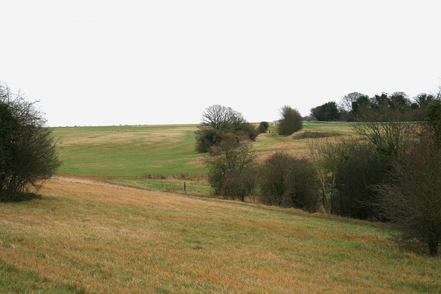
Image: © Hugh Craddock Taken: 26 Dec 2011
Middle Hill seen from Langley Vale Road. Most of the downland seen here is open to horse riding, and all of it is accessible on foot. On the far side of the valley, between the two lines of hedges, is the old alignment of the racecourse. To its left is Middle Hill, an area available to 'hack riders' (those who ride horses other than race horses in training) and much favoured for fast canter work owing to the lengthy upward incline and long grass; the grassland in the foreground is also a hack area. The far end of the racecourse can just be seen at top right: this is where the Derby Stakes begin each June.
Images are licensed for reuse under creativecommons.org/licenses/by-sa/2.0
Image Location
Latitude
51.309809
Longitude
-0.26052