Cross base, Disley parish church
Introduction
The photograph on this page of Cross base, Disley parish church by Dave Dunford as part of the Geograph project.
The Geograph project started in 2005 with the aim of publishing, organising and preserving representative images for every square kilometre of Great Britain, Ireland and the Isle of Man.

There are currently over 7.5m images from over 14,400 individuals and you can help contribute to the project by visiting https://www.geograph.org.uk
Cross base, Disley parish church
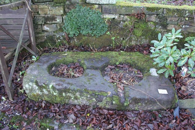
Image: © Dave Dunford Taken: 2 Jan 2012
"Socket stone for two crosses: Pre-conquest but found at Image in 1958. Massive sub-rectangular stone slab with 2 circular holes of different sizes. Shallow grooves run through the centres of these holes and perpendicular to them, a piece of lead is set into one of them. Thought to be the setting for 2 Anglo-Saxon crosses now lost. (Trans. Lancs. and Ches. Ant. Soc. vol 58, 142)." I've heard it claimed that Image were once mounted in this stone, but the above (quoted in the English Heritage listing) would appear to contradict the claim.
Images are licensed for reuse under creativecommons.org/licenses/by-sa/2.0
Image Location
Latitude
53.357283
Longitude
-2.040077