Remains of Bannister Green Halt
Introduction
The photograph on this page of Remains of Bannister Green Halt by Phillip Williams as part of the Geograph project.
The Geograph project started in 2005 with the aim of publishing, organising and preserving representative images for every square kilometre of Great Britain, Ireland and the Isle of Man.

There are currently over 7.5m images from over 14,400 individuals and you can help contribute to the project by visiting https://www.geograph.org.uk
Remains of Bannister Green Halt
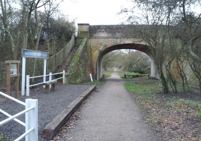
Image: © Phillip Williams Taken: 25 Dec 2011
See.. http://en.wikipedia.org/wiki/Bannister_Green_Halt_railway_station Looking west along the track-bed of the old Bishop's Stortford, Dunmow and Braintree line just east of the B147 with the road being carried over the bridge. The old track-bed is now the "Flitch Way", for horse-riders, cyclists & walkers.
Images are licensed for reuse under creativecommons.org/licenses/by-sa/2.0
Image Location
Latitude
51.868076
Longitude
0.454251