Pompren ger Glyncasnod / Footbridge near Glyncasnod
Introduction
The photograph on this page of Pompren ger Glyncasnod / Footbridge near Glyncasnod by Alan Richards as part of the Geograph project.
The Geograph project started in 2005 with the aim of publishing, organising and preserving representative images for every square kilometre of Great Britain, Ireland and the Isle of Man.

There are currently over 7.5m images from over 14,400 individuals and you can help contribute to the project by visiting https://www.geograph.org.uk
Pompren ger Glyncasnod / Footbridge near Glyncasnod
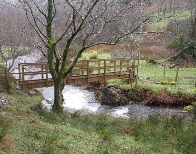
Image: © Alan Richards Taken: 26 Dec 2011
Pompren gymharol newydd yn rhychwantu Afon Dulais ger Ffarm Glyn Casnod yn nhreflan Cwmcerdinen. Mae'r llwybr yn arwain lan at y rhostir agored ac mae'r afon yn llifo i mewn i Afon Llwchwr ym Mhontarddulais ryw bedair milltir i ffwrdd A footbridge spanning Afon Dulais near Glyn Casnod Farm in the hamlet of Cwmcerdinen. The footpath climbs up to the open moorland and the river flows into the Llwchwr (Loughor) River at Pontarddulais located some four miles away.
Images are licensed for reuse under creativecommons.org/licenses/by-sa/2.0
Image Location
Latitude
51.737285
Longitude
-3.978938