Barclays Stockport
Introduction
The photograph on this page of Barclays Stockport by Gerald England as part of the Geograph project.
The Geograph project started in 2005 with the aim of publishing, organising and preserving representative images for every square kilometre of Great Britain, Ireland and the Isle of Man.

There are currently over 7.5m images from over 14,400 individuals and you can help contribute to the project by visiting https://www.geograph.org.uk
Barclays Stockport
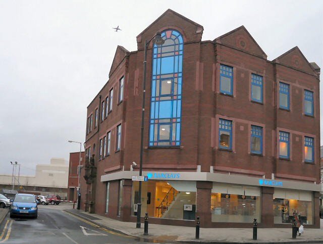
Image: © Gerald England Taken: 24 Dec 2011
Barclays bank in the centre of Stockport is built over the infant River Mersey which was culverted from the late 1930s and now flow under the Merseyway Shopping Centre. Lancashire Bridge and the adjacent coaching inn, the Buck & Dog were demolished. The entrance to the pub with its ornate stonework Image was preserved on the Percy Street side of the building.
Images are licensed for reuse under creativecommons.org/licenses/by-sa/2.0
Image Location
Latitude
53.412554
Longitude
-2.158527