Little Rissington Airfield [3]
Introduction
The photograph on this page of Little Rissington Airfield [3] by Michael Dibb as part of the Geograph project.
The Geograph project started in 2005 with the aim of publishing, organising and preserving representative images for every square kilometre of Great Britain, Ireland and the Isle of Man.

There are currently over 7.5m images from over 14,400 individuals and you can help contribute to the project by visiting https://www.geograph.org.uk
Little Rissington Airfield [3]
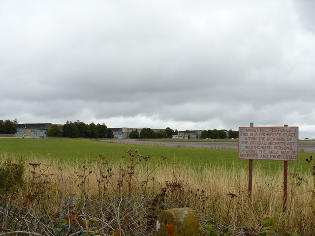
Image: © Michael Dibb Taken: 4 Sep 2011
Much of the former RAF Little Rissington has become a business park but it also houses an active Flying Training aerodrome under No.22 (Training) Group. This view is of some hangars and other assorted buildings that dot the airfield, seen from the minor road. The airfield perimeter is dotted with warning signs. The airfield was built in 1937 and soon came to dominate the village and the surrounding area with the residential quarters belonging to it housing nine-tenths of the population of the parish. For many years it was the home of the Central Flying School and a fascinating history is at http://www.centralflyingschool.org.uk/History/History3.htm There is a RAF Memorial Window in Little Rissington church and part of the graveyard was reserved for those killed whilst on duty at RAF Little Rissington.
Images are licensed for reuse under creativecommons.org/licenses/by-sa/2.0
Image Location
Latitude
51.870806
Longitude
-1.697556