High Street
Introduction
The photograph on this page of High Street by Ian Capper as part of the Geograph project.
The Geograph project started in 2005 with the aim of publishing, organising and preserving representative images for every square kilometre of Great Britain, Ireland and the Isle of Man.

There are currently over 7.5m images from over 14,400 individuals and you can help contribute to the project by visiting https://www.geograph.org.uk
High Street
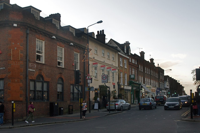
Image: © Ian Capper Taken: 3 Dec 2011
Perhaps the shortest High Street in the country, being less than 100m long. Historically, it formed part of the main route out of St Albans to the northwest, originally through its extension along George Street, and later along Verulam Road, following the building of this improved route by Thomas Telford in 1825. The buildings on the left now are occupied by the Cote Brasserie. Prior to 2009 it was a pub, The Vintry, with the nearer part previously being a Barclays Bank. They are grade II listed - see www.historicengland.org.uk/listing/the-list/list-entry/1103128.
Images are licensed for reuse under creativecommons.org/licenses/by-sa/2.0
Image Location
Latitude
51.750922
Longitude
-0.340299