Black Prince Road
Introduction
The photograph on this page of Black Prince Road by Martin Addison as part of the Geograph project.
The Geograph project started in 2005 with the aim of publishing, organising and preserving representative images for every square kilometre of Great Britain, Ireland and the Isle of Man.

There are currently over 7.5m images from over 14,400 individuals and you can help contribute to the project by visiting https://www.geograph.org.uk
Black Prince Road
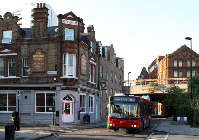
Image: © Martin Addison Taken: 2 Dec 2011
Seen at the junction with Vauxhall Walk. The Queens Head stands on the corner with a Penny Black stamp as its pub sign. However, the old signage is fading and this one time Courage house is now a café / restaurant - though the sign above the door suggests that it has also been a free house. Passing is a bus on the 360 route from Kensington to Elephant & Castle. This is a high frequency route that is operated by Go Ahead London Central. The vehicle is a Wrightbus Electrocity - a hybrid vehicle using VDL mechanical parts.
Images are licensed for reuse under creativecommons.org/licenses/by-sa/2.0
Image Location
Latitude
51.491702
Longitude
-0.119062