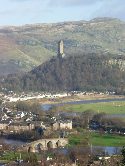
The Abbey Craig from Stirling Castle
Introduction
The photograph on this page of The Abbey Craig from Stirling Castle by kim traynor as part of the Geograph project.
The Geograph project started in 2005 with the aim of publishing, organising and preserving representative images for every square kilometre of Great Britain, Ireland and the Isle of Man.
There are currently over 7.5m images from over 14,400 individuals and you can help contribute to the project by visiting https://www.geograph.org.uk

Image: © kim traynor Taken: 27 Nov 2011
A view from the esplanade of Stirling Castle showing the Old Stirling Bridge over the River Forth and the Wallace Monument against the splendid backdrop of the Ochil Hills. "As this little, but very pleasant spot, was on the north side of the castle, we had from thence a most agreeable prospect indeed over the valley and the river; as it is truly beautiful, so it is what the people of Sterling justly boast of, and, indeed, seldom forget it, I mean the meanders, or reaches of the River Forth. They are so spacious, and return so near themselves, with so regular and exactly a sweep, that, I think, the like is not to be seen in Britain, if it is in Europe, especially where the river is so large also. (...) The form of this winding may be conceived of a little by the length of the way, for it is near twenty miles from Sterling to Alloway [Alloa] by water, and hardly four miles by land."-- Daniel Defoe, A Tour Thro' The Whole Island of Great Britain, 1724-6

