Looking along the lane past Ladwood Farm
Introduction
The photograph on this page of Looking along the lane past Ladwood Farm by John Baker as part of the Geograph project.
The Geograph project started in 2005 with the aim of publishing, organising and preserving representative images for every square kilometre of Great Britain, Ireland and the Isle of Man.

There are currently over 7.5m images from over 14,400 individuals and you can help contribute to the project by visiting https://www.geograph.org.uk
Looking along the lane past Ladwood Farm
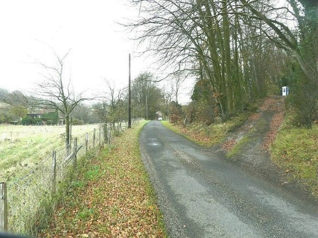
Image: © John Baker Taken: 29 Nov 2011
The farmhouse of Ladwood Farm can be seen on the left. The track ascending the hillside is marked on the first edition of the one-inch Ordnance Survey map. It was used by the owners of Winterdown Farm to access the valley having a less steep gradient, than Reece Lane Image , as it cut diagonally across the hillside. The blue and white rectangular box at the top of the track is a Portaloo for use when paint-ball games are being held in the wood.
Images are licensed for reuse under creativecommons.org/licenses/by-sa/2.0
Image Location
Latitude
51.147013
Longitude
1.147792