Old narrow gauge railway? Belfast
Introduction
The photograph on this page of Old narrow gauge railway? Belfast by Albert Bridge as part of the Geograph project.
The Geograph project started in 2005 with the aim of publishing, organising and preserving representative images for every square kilometre of Great Britain, Ireland and the Isle of Man.

There are currently over 7.5m images from over 14,400 individuals and you can help contribute to the project by visiting https://www.geograph.org.uk
Old narrow gauge railway? Belfast
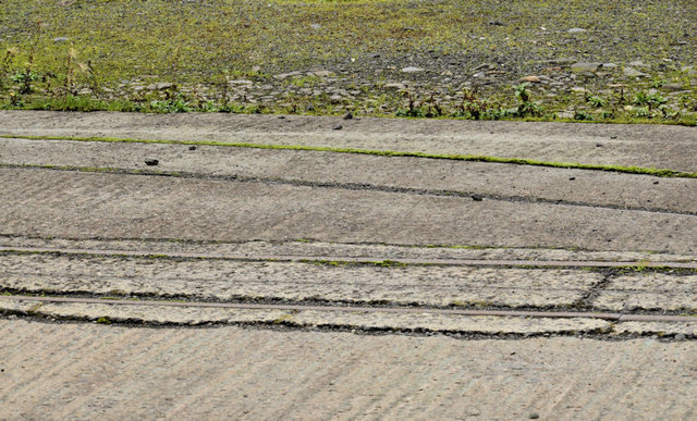
Image: © Albert Bridge Taken: 2 Dec 2011
See Image Part of the same site (just out of picture to the right), looking through a palisade fence at what seems to be two narrow gauge railway sidings. They are visible in the lower part of the previous photograph. Not mentioned in the otherwise comprehensive “Johnson’s [railway] Atlas and Gazetteer”. 100 years ago this part of Duncrue Street was used by several businesses connected with the timber trade. At a guess (and I might be completely wrong) it’s possible that they were part of an internal horse-drawn tramway.
Images are licensed for reuse under creativecommons.org/licenses/by-sa/2.0
Image Location
Latitude
54.617596
Longitude
-5.917741