The keep at Wark Castle
Introduction
The photograph on this page of The keep at Wark Castle by Walter Baxter as part of the Geograph project.
The Geograph project started in 2005 with the aim of publishing, organising and preserving representative images for every square kilometre of Great Britain, Ireland and the Isle of Man.

There are currently over 7.5m images from over 14,400 individuals and you can help contribute to the project by visiting https://www.geograph.org.uk
The keep at Wark Castle
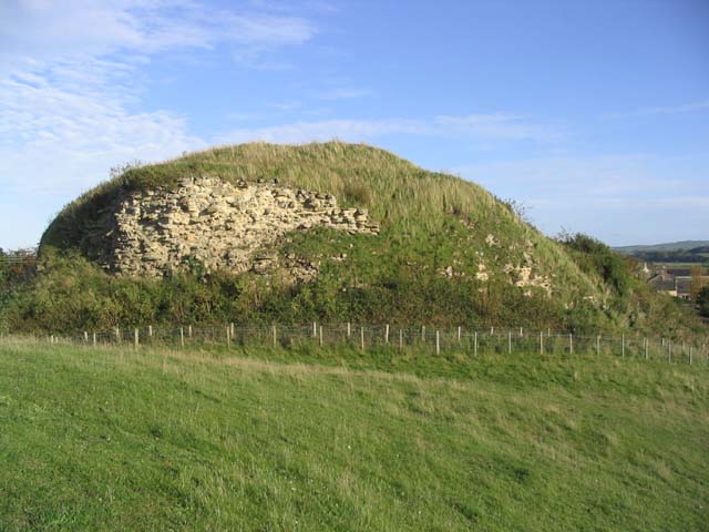
Image: © Walter Baxter Taken: 29 Oct 2006
This large keep on the motte of Wark Castle is now mostly rubble, barely defining the line of the keep walls below a blanket of scrub. The castle dates back to the early 12th century. (Source: Borders and Berwick, An Architectural Guide by Charles Alexander Strang)
Images are licensed for reuse under creativecommons.org/licenses/by-sa/2.0
Image Location


Leaflet Map data © OpenStreetMap
Latitude
55.641616
Longitude
-2.281963