Former St Peter's School, Lambeth
Introduction
The photograph on this page of Former St Peter's School, Lambeth by David Anstiss as part of the Geograph project.
The Geograph project started in 2005 with the aim of publishing, organising and preserving representative images for every square kilometre of Great Britain, Ireland and the Isle of Man.

There are currently over 7.5m images from over 14,400 individuals and you can help contribute to the project by visiting https://www.geograph.org.uk
Former St Peter's School, Lambeth
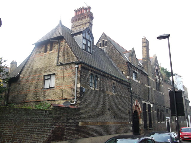
Image: © David Anstiss Taken: 20 Nov 2011
Former school now converted into a terrace of houses on St Oswald's Place. The building is Grade II listed. See http://www.britishlistedbuildings.co.uk/en-204620-former-st-peter-s-school-38-lambeth for more details about the building.
Images are licensed for reuse under creativecommons.org/licenses/by-sa/2.0
Image Location
Latitude
51.48702
Longitude
-0.118678