Cadoxton Place
Introduction
The photograph on this page of Cadoxton Place by Ian Capper as part of the Geograph project.
The Geograph project started in 2005 with the aim of publishing, organising and preserving representative images for every square kilometre of Great Britain, Ireland and the Isle of Man.

There are currently over 7.5m images from over 14,400 individuals and you can help contribute to the project by visiting https://www.geograph.org.uk
Cadoxton Place
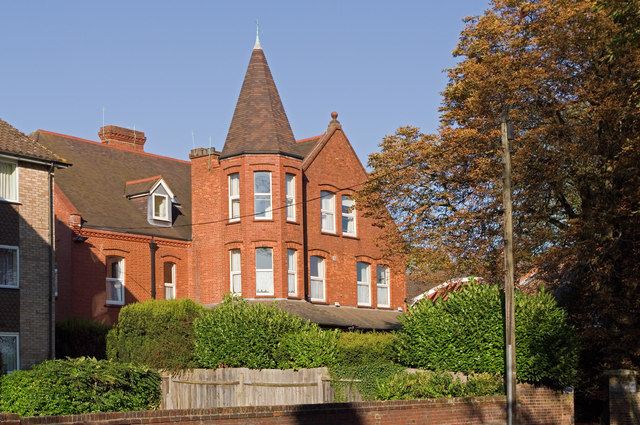
Image: © Ian Capper Taken: 2 Oct 2011
A large Victorian mansion in Avenue Road, originally named St Raphael's, which from 1932 to 2010 served as a care home for blind and partially sighted people, run by the St John's Guild. It has since been subdivided into flats and renamed. The building is locally listed.
Images are licensed for reuse under creativecommons.org/licenses/by-sa/2.0
Image Location
Latitude
51.757907
Longitude
-0.328742