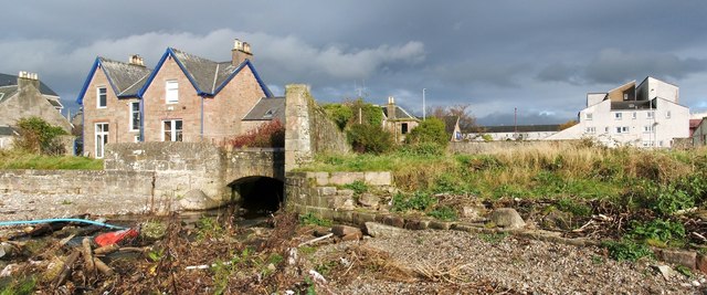
The Milligs Burn
Introduction
The photograph on this page of The Milligs Burn by Lairich Rig as part of the Geograph project.
The Geograph project started in 2005 with the aim of publishing, organising and preserving representative images for every square kilometre of Great Britain, Ireland and the Isle of Man.
There are currently over 7.5m images from over 14,400 individuals and you can help contribute to the project by visiting https://www.geograph.org.uk

Image: © Lairich Rig Taken: 26 Oct 2011
This picture shows the burn flowing, by means of the aperture left of centre, onto the beach at Helensburgh (for a view of the same area from further away, see Image). The burn has its origins at about Image, a short distance to the north-west of the reservoirs (Image and Image) that are to the north of the town; on the way here, it flows through Image, as shown in Image For a view in the opposite direction from about the same point as the present picture, see Image, showing the burn flowing towards the Clyde. The name Millig, encountered in various spellings, has been associated with the area for a very long time. In the item Image, I record its use from as early as 1225; see that item for more information. [Regarding the founding of Helensburgh (in 1777) on the lands of Millig, the first volume of "The Chiefs of Colquhoun and their Country" (William Fraser, 1869) explains that "the barony of Malligs" had previously been owned by Sir John Shaw of Greenock; when he died in 1752, those lands went first to his widow, and then to his only child, Margaret, and her husband, Lord Cathcart. These sold it to Sir James Colquhoun (1714-1786), 1st Baronet Colquhoun of Luss; the last payment was made in June 1756. James wished to create a burgh of barony on the lower parts of the lands; he would eventually name it after his wife, Lady Helen.]

