South Acton: Bollo Lane and the former Acton Loop Line bridge
Introduction
The photograph on this page of South Acton: Bollo Lane and the former Acton Loop Line bridge by Nigel Cox as part of the Geograph project.
The Geograph project started in 2005 with the aim of publishing, organising and preserving representative images for every square kilometre of Great Britain, Ireland and the Isle of Man.

There are currently over 7.5m images from over 14,400 individuals and you can help contribute to the project by visiting https://www.geograph.org.uk
South Acton: Bollo Lane and the former Acton Loop Line bridge
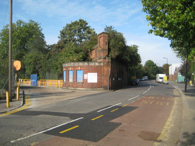
Image: © Nigel Cox Taken: 25 Sep 2011
The brick bridge abutment on the left side of Bollo Lane here is virtually all that remains of the railway that once linked Acton Town and South Acton stations. Passenger services operated from 1905 to 1959, latterly with an unusual single coach shuttle service. During the dismantling of the bridge it apparently collapsed into Bollo Lane and had to be broken up on the spot.
Images are licensed for reuse under creativecommons.org/licenses/by-sa/2.0
Image Location
Latitude
51.498221
Longitude
-0.273959