Plaque closeup
Introduction
The photograph on this page of Plaque closeup by Jeremy Bolwell as part of the Geograph project.
The Geograph project started in 2005 with the aim of publishing, organising and preserving representative images for every square kilometre of Great Britain, Ireland and the Isle of Man.

There are currently over 7.5m images from over 14,400 individuals and you can help contribute to the project by visiting https://www.geograph.org.uk
Plaque closeup
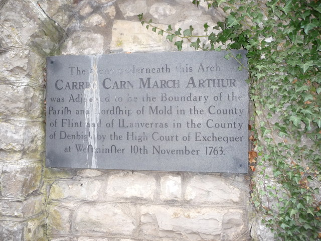
Image: © Jeremy Bolwell Taken: 16 Nov 2011
A boundary dispute that went all the way to the highest courts in the land at the time.
Images are licensed for reuse under creativecommons.org/licenses/by-sa/2.0
Image Location
Latitude
53.155072
Longitude
-3.194511