The ruins of Pinmerry
Introduction
The photograph on this page of The ruins of Pinmerry by Gordon Brown as part of the Geograph project.
The Geograph project started in 2005 with the aim of publishing, organising and preserving representative images for every square kilometre of Great Britain, Ireland and the Isle of Man.

There are currently over 7.5m images from over 14,400 individuals and you can help contribute to the project by visiting https://www.geograph.org.uk
The ruins of Pinmerry
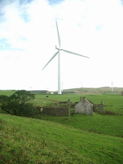
Image: © Gordon Brown Taken: 29 Oct 2006
One of the Hadyard Hill wind turbines behind. These are 2.3MW turbines, 52 in all, making this, at time of commissioning in early 2006, the UK's biggest wind farm
Images are licensed for reuse under creativecommons.org/licenses/by-sa/2.0
Image Location
Latitude
55.216014
Longitude
-4.766498