East Port marker stone, King Street
Introduction
The photograph on this page of East Port marker stone, King Street by kim traynor as part of the Geograph project.
The Geograph project started in 2005 with the aim of publishing, organising and preserving representative images for every square kilometre of Great Britain, Ireland and the Isle of Man.

There are currently over 7.5m images from over 14,400 individuals and you can help contribute to the project by visiting https://www.geograph.org.uk
East Port marker stone, King Street
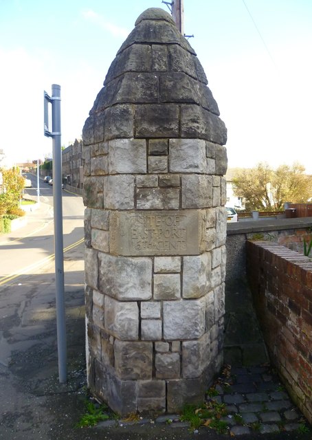
Image: © kim traynor Taken: 16 Oct 2011
A marker stone indicating the former presence of a port into the Royal Burgh of Inverkeithing. This is the only one of three that has survived.
Images are licensed for reuse under creativecommons.org/licenses/by-sa/2.0
Image Location
Latitude
56.031559
Longitude
-3.393667