2011 : North of east from Mill Lane
Introduction
The photograph on this page of 2011 : North of east from Mill Lane by Maurice Pullin as part of the Geograph project.
The Geograph project started in 2005 with the aim of publishing, organising and preserving representative images for every square kilometre of Great Britain, Ireland and the Isle of Man.

There are currently over 7.5m images from over 14,400 individuals and you can help contribute to the project by visiting https://www.geograph.org.uk
2011 : North of east from Mill Lane
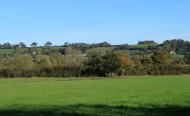
Image: © Maurice Pullin Taken: 28 Oct 2011
Over a foreground pasture to the Cotswold escarpment. Little Sodbury is to the left, its church tower stands out. The top end of Old Sodbury is on the right. A somewhat grimy looking tower** standing on the highest part of the hill behind marks a ventilation shaft from Sodbury rail tunnel, a heap of spoil dumped there when the tunnel was dug stands beside it. You may need the larger version to see the detail. ** These towers were built of blue engineering bricks, hence the grimy appearance from a distance.
Images are licensed for reuse under creativecommons.org/licenses/by-sa/2.0
Image Location
Latitude
51.527221
Longitude
-2.375168