Pillbox near Pry Holding, Purton, Wiltshire
Introduction
The photograph on this page of Pillbox near Pry Holding, Purton, Wiltshire by Brian Robert Marshall as part of the Geograph project.
The Geograph project started in 2005 with the aim of publishing, organising and preserving representative images for every square kilometre of Great Britain, Ireland and the Isle of Man.

There are currently over 7.5m images from over 14,400 individuals and you can help contribute to the project by visiting https://www.geograph.org.uk
Pillbox near Pry Holding, Purton, Wiltshire
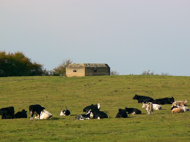
Image: © Brian Robert Marshall Taken: 24 Oct 2011
The pillbox is a WWII Type FW3/22 reinforced concrete pillbox situated at SU11108790. It was part of GHQ Line: Red - GHQ Stop Line running from south of Malmesbury to west of Reading. It sits on the 100 metre contour about 200 metres east of the minor B4553 road running north to south from Crosslanes Farm to Common Platt. It remains as a reminder of the dark days of 1940 and it is somehow reassuring to know that it still stands sentinel over those of us who live in these parts should some die-hard Nazi decide to dust off Hitler's plans for Operation Sealion.
Images are licensed for reuse under creativecommons.org/licenses/by-sa/2.0
Image Location
Latitude
51.589934
Longitude
-1.841027