Watermeadows Brick Arch
Introduction
The photograph on this page of Watermeadows Brick Arch by Nigel Mykura as part of the Geograph project.
The Geograph project started in 2005 with the aim of publishing, organising and preserving representative images for every square kilometre of Great Britain, Ireland and the Isle of Man.

There are currently over 7.5m images from over 14,400 individuals and you can help contribute to the project by visiting https://www.geograph.org.uk
Watermeadows Brick Arch
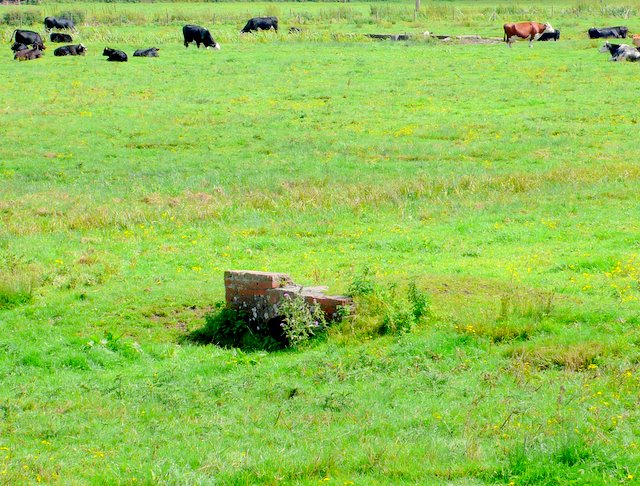
Image: © Nigel Mykura Taken: 24 Aug 2011
This shows a simple brick arch bridge that at one time crossed one of the water supply channels for the water meadows. The strength of the arch construction means that the bridge still stands in the middle of a field while most of the other evidence of watermeadows disappeared many years previously.
Images are licensed for reuse under creativecommons.org/licenses/by-sa/2.0
Image Location
Latitude
51.098868
Longitude
-1.82115