Footbridge over the Ballagan Burn
Introduction
The photograph on this page of Footbridge over the Ballagan Burn by Lairich Rig as part of the Geograph project.
The Geograph project started in 2005 with the aim of publishing, organising and preserving representative images for every square kilometre of Great Britain, Ireland and the Isle of Man.

There are currently over 7.5m images from over 14,400 individuals and you can help contribute to the project by visiting https://www.geograph.org.uk
Footbridge over the Ballagan Burn
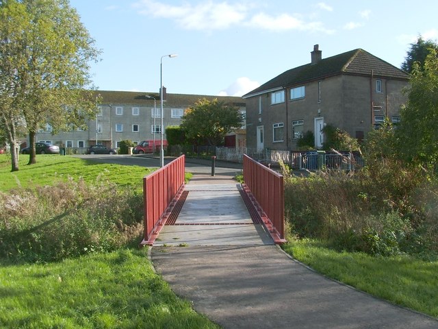
Image: © Lairich Rig Taken: 19 Oct 2011
One of the results of a recent regeneration project was the creation of this footbridge. For a view of the burn from there, see Image As well as this red bridge, there is a blue bridge (just a short distance to the south-west), a network of paths, and various other features (Image, for example). The parts of the Haldane on the far side of the burn are Shandon Crescent (foreground, right), and Shandon Brae (background, left).
Images are licensed for reuse under creativecommons.org/licenses/by-sa/2.0
Image Location
Latitude
56.00438
Longitude
-4.570107