Water Mill on the Colne at Uxbridge
Introduction
The photograph on this page of Water Mill on the Colne at Uxbridge by Des Blenkinsopp as part of the Geograph project.
The Geograph project started in 2005 with the aim of publishing, organising and preserving representative images for every square kilometre of Great Britain, Ireland and the Isle of Man.

There are currently over 7.5m images from over 14,400 individuals and you can help contribute to the project by visiting https://www.geograph.org.uk
Water Mill on the Colne at Uxbridge
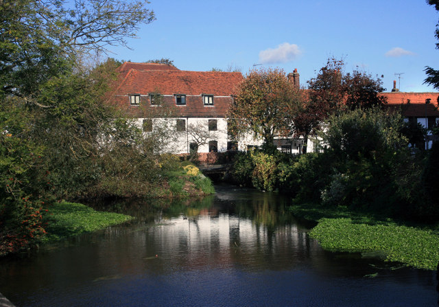
Image: © Des Blenkinsopp Taken: 17 Oct 2011
A mid 18C mill on one of the complex of channels which form the lower Colne. The millstream leaves the main river just by the A40 bridge in the square to the north while the rest of river goes on to join the Grand Union Canal above Uxbridge Lock. So it's same head of water operating the mill as is going through the lock although the two structures are some way apart. The streams rejoin just downstream of the bridge where I'm standing.
Images are licensed for reuse under creativecommons.org/licenses/by-sa/2.0
Image Location
Latitude
51.551681
Longitude
-0.485697