Undine Street, Tooting
Introduction
The photograph on this page of Undine Street, Tooting by Malc McDonald as part of the Geograph project.
The Geograph project started in 2005 with the aim of publishing, organising and preserving representative images for every square kilometre of Great Britain, Ireland and the Isle of Man.

There are currently over 7.5m images from over 14,400 individuals and you can help contribute to the project by visiting https://www.geograph.org.uk
Undine Street, Tooting
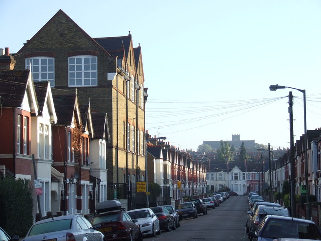
Image: © Malc McDonald Taken: 16 Oct 2011
Undine Street is a residential street close to Tooting Broadway. The taller building to the left hand side is a school. On the skyline is All Saints' Church, built between 1903 and 1906.
Images are licensed for reuse under creativecommons.org/licenses/by-sa/2.0
Image Location
Latitude
51.426531
Longitude
-0.166044