Narrow lane into Tremar Coombe
Introduction
The photograph on this page of Narrow lane into Tremar Coombe by Eric Foster as part of the Geograph project.
The Geograph project started in 2005 with the aim of publishing, organising and preserving representative images for every square kilometre of Great Britain, Ireland and the Isle of Man.

There are currently over 7.5m images from over 14,400 individuals and you can help contribute to the project by visiting https://www.geograph.org.uk
Narrow lane into Tremar Coombe
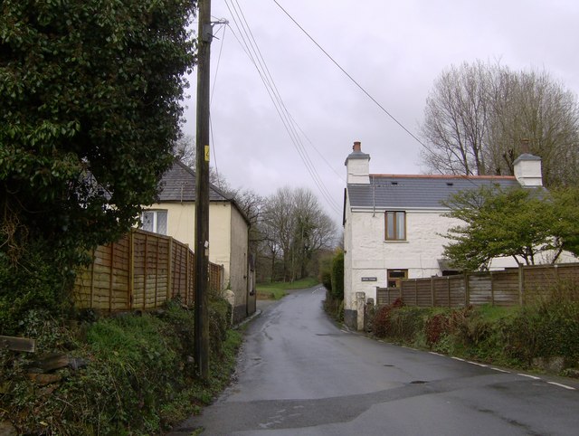
Image: © Eric Foster Taken: 16 Mar 2008
Who ever built these two houses could not have realized the potential bottleneck it would cause when motor cars replaced other modes of transport. This now busy road leads into Tremar Coombe, the coombe meaning valley, and the Tre meaning homestead and mar possibly meaning mark. You then get the homestead of mark in the valley. Before the discovery of copper at Crows Nest nearby, Tremar was just a common, so before 1841 only a couple of dwellings existed on the old tithe map. Between 1841 and 1880 houses were built to support the mining industry, more modern houses later added to provide a mix of old and modern.
Images are licensed for reuse under creativecommons.org/licenses/by-sa/2.0
Image Location
Latitude
50.487377
Longitude
-4.457166