Barton House SW6
Introduction
The photograph on this page of Barton House SW6 by Derek Harper as part of the Geograph project.
The Geograph project started in 2005 with the aim of publishing, organising and preserving representative images for every square kilometre of Great Britain, Ireland and the Isle of Man.

There are currently over 7.5m images from over 14,400 individuals and you can help contribute to the project by visiting https://www.geograph.org.uk
Barton House SW6
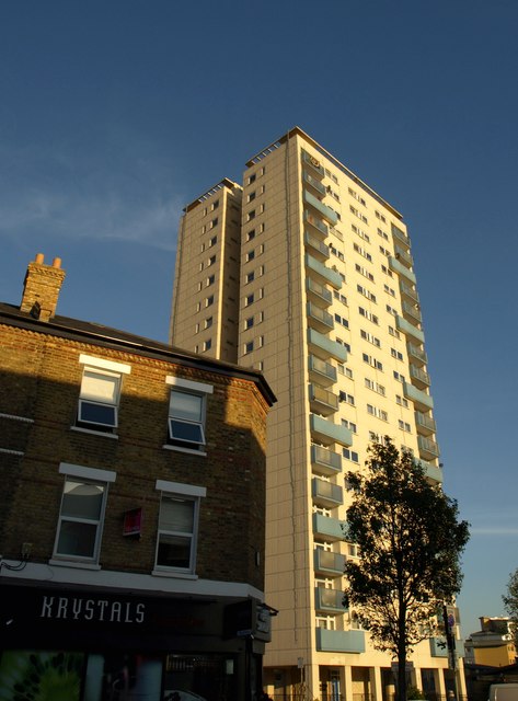
Image: © Derek Harper Taken: 14 Oct 2011
A view of the 76-flat block shown in Image, from further northwest along Wandsworth Bridge Road. In the foreground is a convenience store.
Images are licensed for reuse under creativecommons.org/licenses/by-sa/2.0
Image Location
Latitude
51.468089
Longitude
-0.190006