Holywell Lodge
Introduction
The photograph on this page of Holywell Lodge by Ian Capper as part of the Geograph project.
The Geograph project started in 2005 with the aim of publishing, organising and preserving representative images for every square kilometre of Great Britain, Ireland and the Isle of Man.

There are currently over 7.5m images from over 14,400 individuals and you can help contribute to the project by visiting https://www.geograph.org.uk
Holywell Lodge
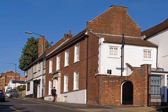
Image: © Ian Capper Taken: 2 Oct 2011
The frontage of this building dates from the early 19th century, although the building itself is probably older. Grade II listed - see www.historicengland.org.uk/listing/the-list/list-entry/1103096) Beyond are the half timbered no 39 (15th century, grade II listed - see www.historicengland.org.uk/listing/the-list/list-entry/1347143) and, continuous with it, on the corner with Sopwell Lane, is the 15th century former Crown and Anchor Inn, one of many former coaching inns on Holywell Hill, given St Albans' position on the old coaching route from London to the north, which came along Sopwell Lane and then turned up Holywell Hill - the old carriage entrance can be seen in the photo. This building is grade II* listed - see www.historicengland.org.uk/listing/the-list/list-entry/1103095.
Images are licensed for reuse under creativecommons.org/licenses/by-sa/2.0
Image Location
Latitude
51.748809
Longitude
-0.340927