Coastguard cottages, Portwrinkle
Introduction
The photograph on this page of Coastguard cottages, Portwrinkle by Derek Harper as part of the Geograph project.
The Geograph project started in 2005 with the aim of publishing, organising and preserving representative images for every square kilometre of Great Britain, Ireland and the Isle of Man.

There are currently over 7.5m images from over 14,400 individuals and you can help contribute to the project by visiting https://www.geograph.org.uk
Coastguard cottages, Portwrinkle
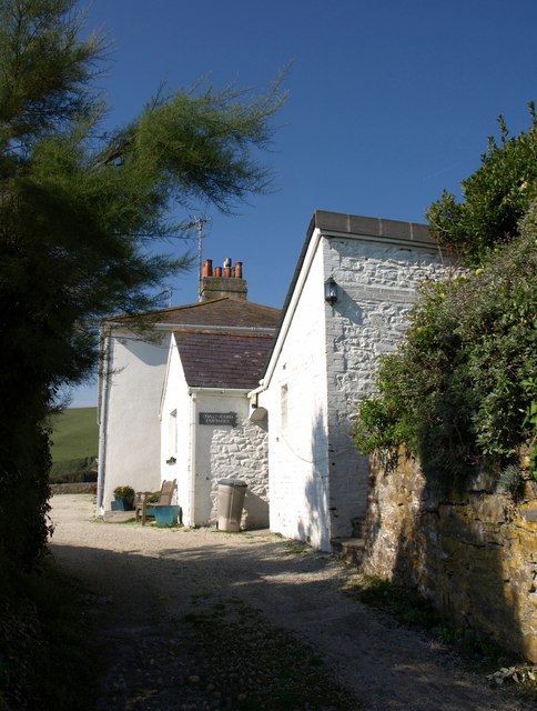
Image: © Derek Harper Taken: 2 Oct 2011
Seen from Donkey Lane, the steep road at the west end of the village that was used by donkeys hauling carts of pilchards up from the harbour. Some of the coastguard cottages are now holiday homes.
Images are licensed for reuse under creativecommons.org/licenses/by-sa/2.0
Image Location
Latitude
50.362132
Longitude
-4.314437