Railway crossing, Aberkenfig
Introduction
The photograph on this page of Railway crossing, Aberkenfig by eswales as part of the Geograph project.
The Geograph project started in 2005 with the aim of publishing, organising and preserving representative images for every square kilometre of Great Britain, Ireland and the Isle of Man.

There are currently over 7.5m images from over 14,400 individuals and you can help contribute to the project by visiting https://www.geograph.org.uk
Railway crossing, Aberkenfig
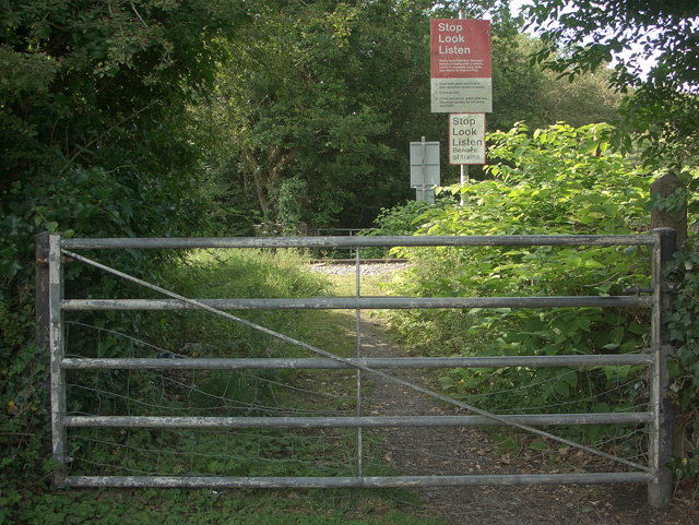
Image: © eswales Taken: 5 Aug 2011
Lying off Meadow Street in Aberkenfig, the southern entrance to a foot crossing over the Margam to Tondu railway line. The crossing has traditionally provided access from the village to a public footpath running towards Parc Slip Nature Park. It now also connects the village to an area of new housing which lies 100 metres or so to the north of here.
Images are licensed for reuse under creativecommons.org/licenses/by-sa/2.0
Image Location
Latitude
51.541635
Longitude
-3.599964