Brixton Windmill
Introduction
The photograph on this page of Brixton Windmill by Marathon as part of the Geograph project.
The Geograph project started in 2005 with the aim of publishing, organising and preserving representative images for every square kilometre of Great Britain, Ireland and the Isle of Man.

There are currently over 7.5m images from over 14,400 individuals and you can help contribute to the project by visiting https://www.geograph.org.uk
Brixton Windmill
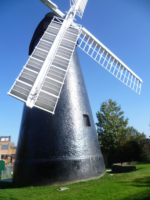
Image: © Marathon Taken: 28 Sep 2011
This is the nearest surviving windmill to the centre of London. It was built in 1816 and was driven entirely by wind until 1862. By then, the surrounding area was so built-up that the sails could no longer operate efficiently and they were removed two years later. In 1964, the London County Council restored it with new sails and some reconditioned machinery, most of which was obtained from a derelict tower mill at Burgh-Le-Marsh in Lincolnshire. This is the view from Windmill Gardens, a small park created to highlight the windmill.
Images are licensed for reuse under creativecommons.org/licenses/by-sa/2.0
Image Location
Latitude
51.453292
Longitude
-0.123951