Forest Mills
Introduction
The photograph on this page of Forest Mills by Matt Nicholas as part of the Geograph project.
The Geograph project started in 2005 with the aim of publishing, organising and preserving representative images for every square kilometre of Great Britain, Ireland and the Isle of Man.

There are currently over 7.5m images from over 14,400 individuals and you can help contribute to the project by visiting https://www.geograph.org.uk
Forest Mills
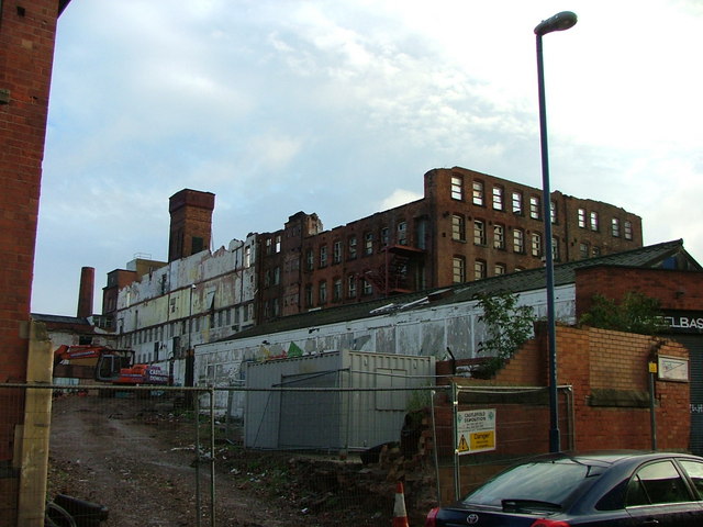
Image: © Matt Nicholas Taken: 21 Oct 2006
Textile Mill situated between Alfreton Road, Boden Street, Thackeray Street, Denman Street East (from where this image was taken) and Highurst Street. An adjoining building has recently been demolished and the pitched roof has been removed, to be replaced with a flat one. Also various repair works are to take place to the wall (according to recent planning applications). However, an aim of the council seems to be demolition...
Images are licensed for reuse under creativecommons.org/licenses/by-sa/2.0
Image Location
Latitude
52.957158
Longitude
-1.167842