Groby Castle
Introduction
The photograph on this page of Groby Castle by Ashley Dace as part of the Geograph project.
The Geograph project started in 2005 with the aim of publishing, organising and preserving representative images for every square kilometre of Great Britain, Ireland and the Isle of Man.

There are currently over 7.5m images from over 14,400 individuals and you can help contribute to the project by visiting https://www.geograph.org.uk
Groby Castle
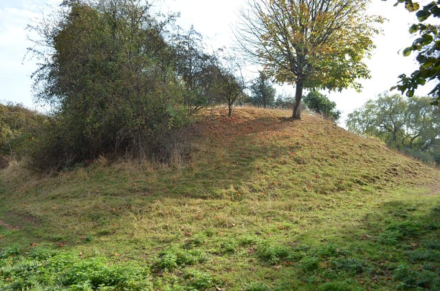
Image: © Ashley Dace Taken: Unknown
The motte of the castle, once hosting a stone tower. It was excavated by Channel 4's Timeteam in 2010. See http://www.castleuk.net/castle_lists_midlands/140/grobycastle.htm From the churchyard, the motte is on private property.
Images are licensed for reuse under creativecommons.org/licenses/by-sa/2.0
Image Location
Latitude
52.663865
Longitude
-1.226949