Gable end in Lorn Road, Stockwell
Introduction
The photograph on this page of Gable end in Lorn Road, Stockwell by Marathon as part of the Geograph project.
The Geograph project started in 2005 with the aim of publishing, organising and preserving representative images for every square kilometre of Great Britain, Ireland and the Isle of Man.

There are currently over 7.5m images from over 14,400 individuals and you can help contribute to the project by visiting https://www.geograph.org.uk
Gable end in Lorn Road, Stockwell
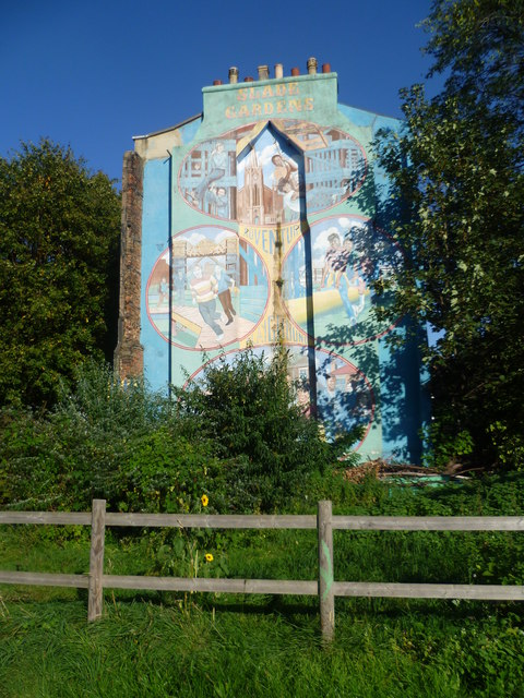
Image: © Marathon Taken: 28 Sep 2011
The photograph is taken from Slade Gardens Adventure Playground which is located on one side of Slade Gardens. Slade Gardens is named after the Slade family, who owned most of the site. During the 1840s most of the land was laid out as housing and streets, but in 1944 a V1 rocket fell here, killing 11 people. London County Council gradually bought up the streets nearby and demolished them to form a park, which opened in 1962. The houses on the south side of Lorn Road end here where their neighbours were demolished and so some time ago the opportunity was taken to brighten up the end gable with this attractive mural to advertise the adventure playground. The playground is run by a charity and is separate to the rest of Slade Gardens. The playground won ‘Best Adventure Playground in London’ in 2003 and was a runner-up in 2006. It is open Tuesday to Friday afternoons from 3.30pm to 6.00pm and Saturdays from 11am to 4pm.
Images are licensed for reuse under creativecommons.org/licenses/by-sa/2.0
Image Location


Leaflet Map data © OpenStreetMap
Latitude
51.471597
Longitude
-0.115857