The top end of Broad Street, Ludlow
Introduction
The photograph on this page of The top end of Broad Street, Ludlow by Jeremy Bolwell as part of the Geograph project.
The Geograph project started in 2005 with the aim of publishing, organising and preserving representative images for every square kilometre of Great Britain, Ireland and the Isle of Man.

There are currently over 7.5m images from over 14,400 individuals and you can help contribute to the project by visiting https://www.geograph.org.uk
The top end of Broad Street, Ludlow
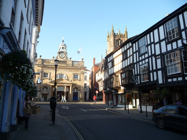
Image: © Jeremy Bolwell Taken: 28 Sep 2011
A much-photographed scene in photgenic Ludlow; the Buttercross building, Valentines Walk overhung by some of the town's oldest timber-framed buildings comprising De Grey's and Bodenham's and of course overlooked by the tower of St. Laurence's.
Images are licensed for reuse under creativecommons.org/licenses/by-sa/2.0
Image Location
Latitude
52.367797
Longitude
-2.719171