Residential development, Swingfield Minnis
Introduction
The photograph on this page of Residential development, Swingfield Minnis by John Baker as part of the Geograph project.
The Geograph project started in 2005 with the aim of publishing, organising and preserving representative images for every square kilometre of Great Britain, Ireland and the Isle of Man.

There are currently over 7.5m images from over 14,400 individuals and you can help contribute to the project by visiting https://www.geograph.org.uk
Residential development, Swingfield Minnis
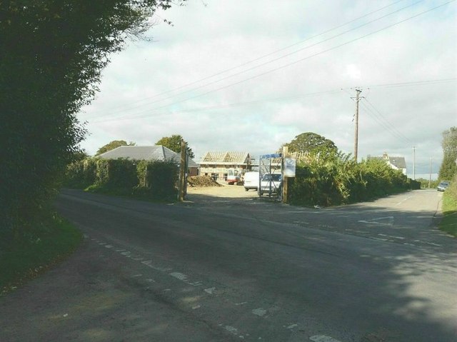
Image: © John Baker Taken: 5 Oct 2011
The site is on land adjoining Swingfield House. Planning permission has been approved, with conditions, by Folkestone and Hythe District Council under application number Y09/0738/SH for the “erection of 6 affordable housing units and provision of new access road”. It appears from the related documents for this planning application that an abattoir one stood on the site, which would have meant that other buildings could be erected, bearing in mind that there are constraints for new buildings in areas of outstanding natural beauty (under which this site falls). The dictionary meaning of ‘lairage’ is a place where cattle are housed. The development also includes provision for a new access road which will emerge onto the lane near the electricity pole. Before the development started, this corner of the site appeared as Image
Images are licensed for reuse under creativecommons.org/licenses/by-sa/2.0
Image Location
Latitude
51.14632
Longitude
1.166765