Boundary stone on NE side of Faringdon Road
Introduction
The photograph on this page of Boundary stone on NE side of Faringdon Road by Roger Templeman as part of the Geograph project.
The Geograph project started in 2005 with the aim of publishing, organising and preserving representative images for every square kilometre of Great Britain, Ireland and the Isle of Man.

There are currently over 7.5m images from over 14,400 individuals and you can help contribute to the project by visiting https://www.geograph.org.uk
Boundary stone on NE side of Faringdon Road
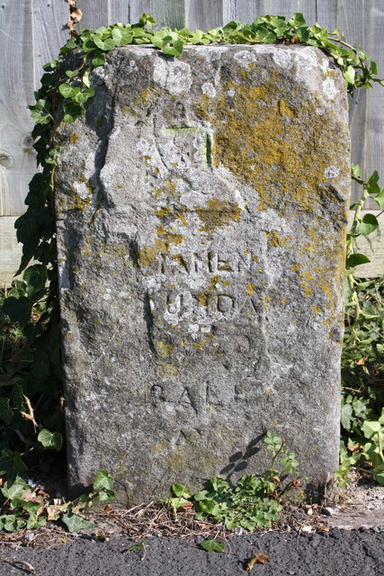
Image: © Roger Templeman Taken: 3 Oct 2011
The stone has an OS benchmark on its right side face Image At the top of front face is the Abingdon Coat of Arms. The words BOUNDARY and RAL can be seen. The RAL probably added recently by someone from the Rutherford Appleton Laboratory.
Images are licensed for reuse under creativecommons.org/licenses/by-sa/2.0
Image Location
Latitude
51.676782
Longitude
-1.298388