Garryloop, Old Dailly
Introduction
The photograph on this page of Garryloop, Old Dailly by Oliver Dixon as part of the Geograph project.
The Geograph project started in 2005 with the aim of publishing, organising and preserving representative images for every square kilometre of Great Britain, Ireland and the Isle of Man.

There are currently over 7.5m images from over 14,400 individuals and you can help contribute to the project by visiting https://www.geograph.org.uk
Garryloop, Old Dailly
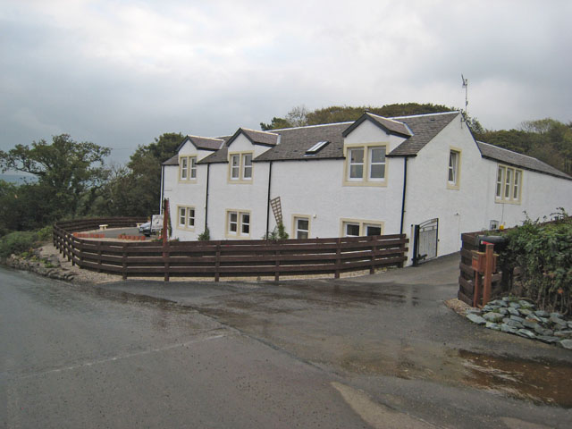
Image: © Oliver Dixon Taken: 14 Oct 2006
Garryloop is the Anglicized form of "Gearaidh Lub" meaning "The Shieling at the bend between arable and hill ground". Notice how succinct Gaelic is compared with English? An old barn and cobbler's cottage, now rebuilt as comfortable modern accommodation, which operates as a well-appointed bed-and-breakfast and base for deer-stalking holidays. http://www.ayrstalk.co.uk/accomodation.asp
Images are licensed for reuse under creativecommons.org/licenses/by-sa/2.0
Image Location


Leaflet Map data © OpenStreetMap
Latitude
55.25346
Longitude
-4.780117