
Earthwork at Lower Bathville
Introduction
The photograph on this page of Earthwork at Lower Bathville by Claire M Jordan as part of the Geograph project.
The Geograph project started in 2005 with the aim of publishing, organising and preserving representative images for every square kilometre of Great Britain, Ireland and the Isle of Man.

There are currently over 7.5m images from over 14,400 individuals and you can help contribute to the project by visiting https://www.geograph.org.uk
Earthwork at Lower Bathville
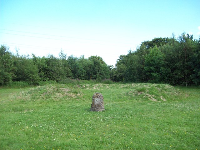
Image: © Claire M Jordan Taken: 13 Jul 2011
The small standing stone was erected by the Boy Scouts during some kind of Millennium celebration, but I haven't been able to find out anything about the horseshoe-shaped earthwork. It definitely pre-dates the local housing estate, because it can be seen in aerial photographs taken before the houses were built. Somebody who has lived nearby for sixteen years told me it was there when he moved in. It doesn't seem to be a marker on top of a septic tank and it's too low and too small to be a sheep-fold, yet it's not marked on the OS map as an ancient monument either. Some kind of Victorian folly, possibly?
Images are licensed for reuse under creativecommons.org/licenses/by-sa/2.0
Image Location

Latitude
55.896269
Longitude
-3.67892