The wonderful apse-style west elevation of Newtown Church
Introduction
The photograph on this page of The wonderful apse-style west elevation of Newtown Church by James Denham as part of the Geograph project.
The Geograph project started in 2005 with the aim of publishing, organising and preserving representative images for every square kilometre of Great Britain, Ireland and the Isle of Man.

There are currently over 7.5m images from over 14,400 individuals and you can help contribute to the project by visiting https://www.geograph.org.uk
The wonderful apse-style west elevation of Newtown Church
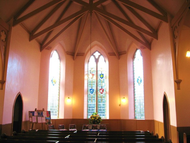
Image: © James Denham Taken: 26 Jan 2011
The first church at Newtown was built as an Anti-Burgher Secession Church in the 1770s. That church was situated near the foot of the hill in the village, near the old railway station. In time, as the congregation grew, a new church was required and duly arrived in 1868, built at the top of the hill, and now a part of the United Presbyterian Church. In 1900 the congregation amalgamated with the Free Kirk to form the United Free Church before,in 1929, coming together with a reunified Church of Scotland where it remains. Source : The Village Kirks of the Scottish Borders - 2011 : The Churches and Churchyards of Roxburghshire - G.A.C. Binnie 2001.
Images are licensed for reuse under creativecommons.org/licenses/by-sa/2.0
Image Location


Leaflet Map data © OpenStreetMap
Latitude
55.575521
Longitude
-2.667052