Carlton Place
Introduction
The photograph on this page of Carlton Place by Thomas Nugent as part of the Geograph project.
The Geograph project started in 2005 with the aim of publishing, organising and preserving representative images for every square kilometre of Great Britain, Ireland and the Isle of Man.

There are currently over 7.5m images from over 14,400 individuals and you can help contribute to the project by visiting https://www.geograph.org.uk
Carlton Place
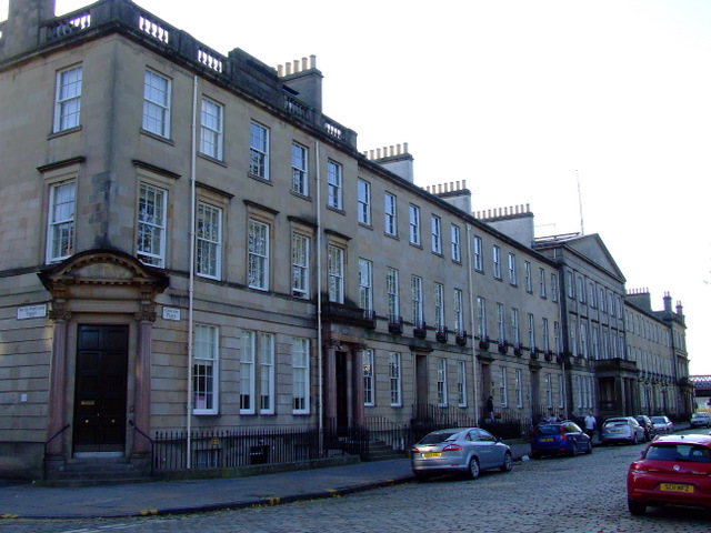
Image: © Thomas Nugent Taken: 24 Sep 2011
The following is from The Glasgow Story website http://www.theglasgowstory.com/image.php?inum=TGSA01088 Carlton Place contains two elegant tenement buildings each of 375 feet in length, with balconies in the middle and at the ends of their facades. The buildings were designed as a single architectural concept, a first for Glasgow, and were intended as the showpiece of Laurieston, the residential suburb built by the brothers John and David Laurie in the early 1800s. The original architect was Peter Nicholson, and the work was completed by John Baird Snr. This photo shows the westernmost of the buildings.
Images are licensed for reuse under creativecommons.org/licenses/by-sa/2.0
Image Location
Latitude
55.85431
Longitude
-4.257072