Cambridge Station: south end
Introduction
The photograph on this page of Cambridge Station: south end by John Sutton as part of the Geograph project.
The Geograph project started in 2005 with the aim of publishing, organising and preserving representative images for every square kilometre of Great Britain, Ireland and the Isle of Man.

There are currently over 7.5m images from over 14,400 individuals and you can help contribute to the project by visiting https://www.geograph.org.uk
Cambridge Station: south end
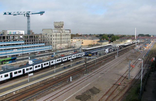
Image: © John Sutton Taken: 27 Sep 2011
The CB1 development is on the left, and work on the new platform and footbridge continues on the extreme right. The tall white castellated building is the former Spiller's Mill, partly destroyed by fire in March 2010 but due to be incorporated in the new development. The picture was taken from the top of the Cambridge Leisure car park.
Images are licensed for reuse under creativecommons.org/licenses/by-sa/2.0
Image Location
Latitude
52.193142
Longitude
0.136315