View east from Westley Bottom
Introduction
The photograph on this page of View east from Westley Bottom by John Goldsmith as part of the Geograph project.
The Geograph project started in 2005 with the aim of publishing, organising and preserving representative images for every square kilometre of Great Britain, Ireland and the Isle of Man.

There are currently over 7.5m images from over 14,400 individuals and you can help contribute to the project by visiting https://www.geograph.org.uk
View east from Westley Bottom
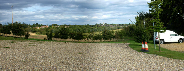
Image: © John Goldsmith Taken: 9 Sep 2011
Originally this was Westley Bottom Farm, but the more observant will note that farms don't usually have neat car parks like this. It has actually been converted to the Eastern England headquarters for the National Trust. The 2-picture panorama shows the valley of the river Linnet, with Bury St. Edmunds in the near distance. The site would have been part of the Ickworth estate of the Earls and Marquesses of Bristol.
Images are licensed for reuse under creativecommons.org/licenses/by-sa/2.0
Image Location
Latitude
52.243601
Longitude
0.669909